THOSE mobile phone holders strategically placed along the Camden Haven coast, could hold the key to beach recovery efforts in the wake of Cyclone Alfred and other heavy storms and high seas.
They are part of the global citizen science photo project CoastSnap, which was founded by researchers at UNSW.
 Advertise with News of The Area today.
It’s worth it for your business.
Message us.
Phone us – (02) 4981 8882.
Email us – media@newsofthearea.com.au
“Having these stations, where we can basically crowd-source and harness all of the smartphones that people have in their pockets, to get… visual records of the changes up and down the coast, is really crucial,” said Associate Professor Mitchell Harley of UNSW’s School of Civil and Environmental Engineering.
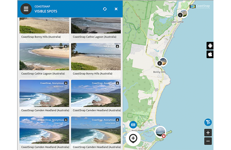
Anyone can place a phone in the cradle, take a photo and follow a prompt to upload their picture to a database.
The photos are then modified to replicate photos taken from space and can be superimposed on satellite imagery to monitor variations in the width of a beach.
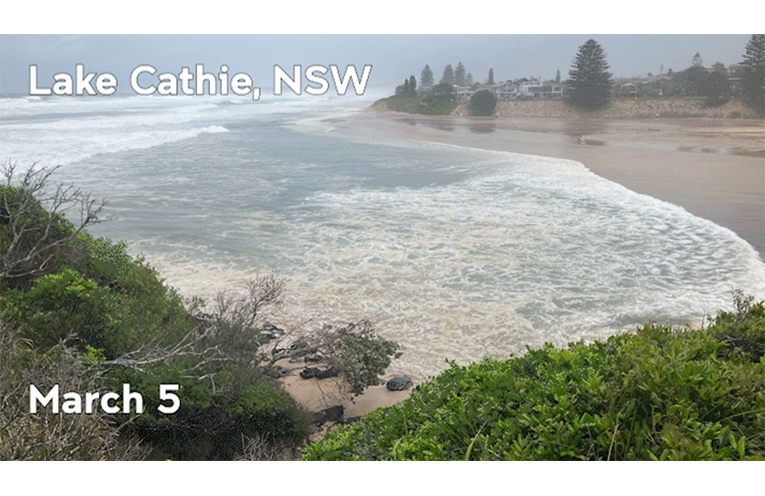
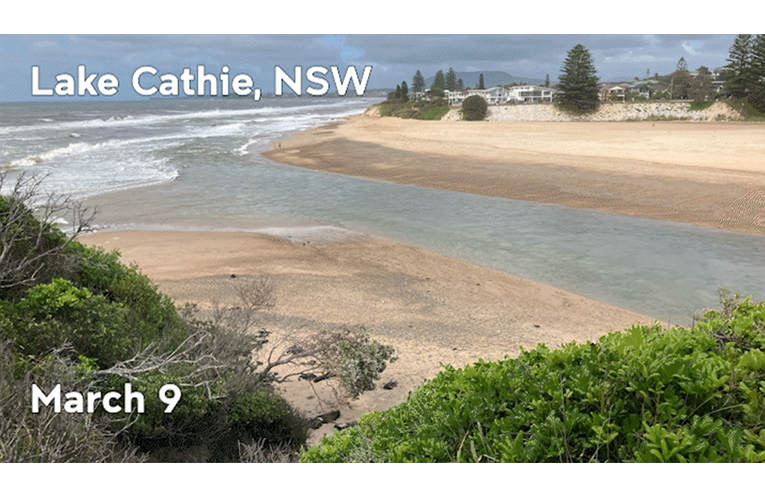
Port Macquarie-Hastings Council (PMHC) has CoastSnap stations at the Lake Cathie Entrance Lookout; Jonathan Dickson Reserve Lookout at Lake Cathie; Rainbow Beach at Bonny Hills; and, Charles Hamey Lookout at Camden Head.
A/Prof. Harley said the modified photos are “equivalent to things you get from professional survey techniques”.
The Lake Cathie stations, for instance, have helped detect when the sandbanks have eroded to the point that dredging is needed to top them up.
Over 100,000 photos have been taken for CoastSnap since 2017.
They have helped provide a continuous picture of beaches for UNSW’s Water Research Laboratory (WRL).
They are also added to a world map at coastsnap.com.
A check of that site shows Camden Haven residents have contributed multiple pictures in recent weeks.
A/Prof. Harley said continued efforts are important, even though Alfred is long gone.
“As we go into April and May, we start to get extra tropical cyclones, the east coast lows… that’s where we can see these really extreme effects.
“[There are] clusters of back-to-back storms that keep eroding the beach and there’s no opportunity for that recovery phase to kick in.”
He said documenting what happens is vital for preparation and ongoing restoration.
“Having those regular snaps really helps us understand how quickly beaches recover.
“Some beaches may recover in a matter of a few months. Others take a lot longer.
Artificial intelligence is providing more uses for the photos and speeding up the process.
A/Prof. Harley is also developing an app with Surf Lifesaving Australia, which will use CoastSnap photos to detect rips.
While that’s still in the works, he is encouraging people to keep taking photos.
“What we find is that once you build up that visual record, then forever more we have that record to inform policy.
“You’re contributing to a dataset without having to do much.”
By Sue STEPHENSON