
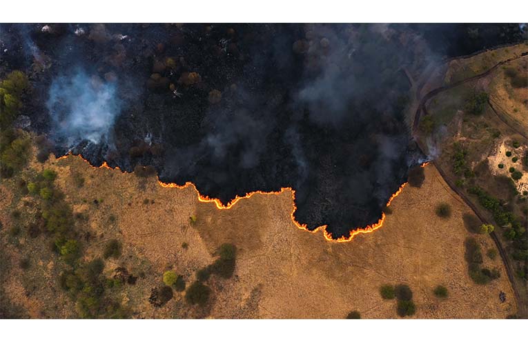
AI-POWERED satellites could help Australian firefighters identify bushfires early and while they are still small enough for crews to extinguish easily, Google has revealed.
The technology giant announced its environmental project called FireSat on Tuesday, created in partnership with climate groups and charities, and designed with Australian bushfires in mind.
 Advertise with News of The Area today.
It’s worth it for your business.
Message us.
Phone us – (02) 4981 8882.
Email us – media@newsofthearea.com.au
The $13 million plan will see a constellation of 52 satellites launched to collect high-resolution images of the Earth every 20 minutes and advanced software deployed to identify potential fires.
In 2026, experts say it could be used to identify fires as small as a classroom.
Google climate and energy research lead Christopher Van Arsdale said satellite technology currently used to identify fires for emergency services produced low-resolution images of the landscape and did so infrequently.
“We realised, searching around, that there was a huge gap in the data available today,” he said.
“We hope by filling this gap, it will help unlock options for better ecosystem management and help sustain the existing balance of our environment.”
Google sought to address the gap, he said, by partnering with Muon Space and the Environmental Defense Fund to create infra-red sensors that could detect smaller fires and to design a group of satellites to cover the globe.
“When we designed the satellite constellation and we were looking at its capabilities, certainly the bushfires in Australia were part of the design requirements,” he said.
“We are going to make this data as broadly available as possible.”
Artificial intelligence and machine-learning software, Mr Van Arsdale said, would be used to compare images to identify fires as small as five square metres.
Earth Fire Alliance executive director Brian Collins said the project’s first satellite would be launched in March next year but comprehensive data may not be available until more satellites were brought online.
“It will be collecting (data) during the 2025 season but it’s one satellite, not a full constellation, and it will be learning and sharing the data with our Australian early adopters,” he said.
“Operationally, our biggest impact to Australia will be in the 2026 time-frame when we launch our next three operational satellites.”
The FireSat project also received assistance from Andrew and Nicola Forrest’s philanthropic Mindaroo Foundation.
CSIRO Data61 senior principal research scientist Mahesh Prakash said gaining access to more information about the location of bushfires would not only assist firefighters but could help scientists predict where fires would break out.
“Providing real-time, high-resolution inputs to such model predictions could assist firefighters in their decision-making processes and make a difference in how wildfires are managed,” he said.
“Any improvements to wildfire detection could aid in enhancing model predictions.”
Google previously introduced bushfire warnings to its Maps application in the US in 2020, and to Australia in December 2021.
By Jennifer DUDLEY-NICHOLSON